Garmin
Garmin GPSMAP 86sci Marine Handheld GPS
LOGIN IN TO SEE MEMBER PRICING IF AVAILABLE.
Use the "Request Quote" button below for quotes, bulk discounts, out-of-stock, regulated products, or tax-exempt sales.
- SKU:
- Garmin-010-02236-02
- UPC:
- 753759228873
- MPN:
- 010-02236-02
- Availability:
- Shipped from our or manufacturers warehouse, You will be notified of any delays. Your card will not be charged until product ships.
- Weight:
- 0.60 LBS





Related Products


Garmin GPSMAP 67i Handheld GPS
Garmin


Garmin Montana 710i Handheld GPS
Garmin


Garmin Montana 710 Handheld GPS
Garmin


Garmin Montana® 760i Handheld GPS
Garmin


Garmin GPS MAP 66i GPS Handheld and Satellite Communicator
Garmin
Description
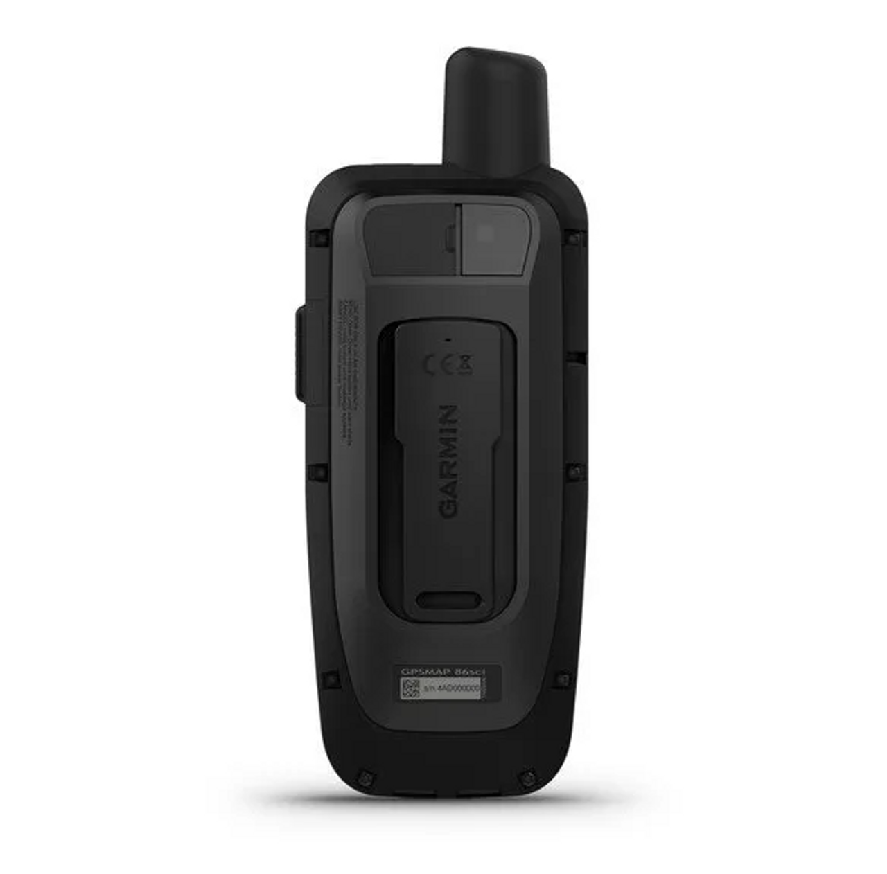
Garmin GPSMAP 86sci Marine Handheld GPS with inReach and BlueChart g3
The Garmin GPSMAP 86sci Marine Handheld GPS is designed for boaters, anglers, sailors, offshore crews, and marine professionals who want a dedicated navigation device that can also provide satellite communication away from cellular coverage. It combines a sunlight-readable 3-inch color display, preloaded BlueChart g3 coastal charts, GPS navigation, inReach two-way satellite messaging, interactive SOS capability, and wireless connectivity with compatible Garmin marine electronics.
The GPSMAP 86sci is particularly useful as a handheld navigation and communication device aboard boats where redundancy matters. It can operate independently for navigation while also connecting with compatible onboard Garmin systems to display boat data and provide remote control of supported autopilot and Fusion marine equipment.
inReach Satellite Communication
Built-in inReach technology allows the GPSMAP 86sci to communicate through the Iridium satellite network when cellular service is unavailable. With an active satellite subscription and a clear view of the sky, users can send and receive two-way text messages, share location information, use tracking features, and access supported inReach services.
For offshore boaters and users traveling beyond normal cellular coverage, satellite communication provides a separate method of staying in contact without depending on a nearby cell tower.
An active satellite subscription is required for inReach messaging, tracking, weather, and SOS functions. Satellite communication performance requires an adequate view of the sky and can be affected by surrounding obstructions.
Interactive SOS Capability
The GPSMAP 86sci includes a dedicated SOS function that can initiate an interactive emergency response through Garmin's supported inReach emergency services when an active satellite subscription is in place.
Unlike a one-way emergency beacon, an interactive SOS allows two-way communication during the incident so information about the emergency can be exchanged while assistance is being coordinated.
The SOS feature is intended as an emergency communication tool and does not replace prudent voyage planning, required safety equipment, or other emergency systems appropriate for the vessel and operating area.
Preloaded BlueChart g3 Coastal Charts
The GPSMAP 86sci comes with preloaded BlueChart g3 coastal charts containing integrated Garmin and Navionics data. Detailed marine cartography provides information for navigating U.S. coastal waters, ports, canals, and other covered marine areas directly from the handheld.
For boaters, this makes the device useful as both a primary handheld navigator and a portable backup to a fixed chartplotter. Chart information remains available on the device without depending on a smartphone connection.
3-Inch Sunlight-Readable Color Display
The GPSMAP 86sci uses a 3-inch transflective 65K-color display with a 240 x 400-pixel resolution. The display is designed to remain readable outdoors, including in the bright conditions commonly encountered on open water.
Physical buttons and a directional pad provide control without relying on a touchscreen. This can be particularly practical on a moving boat, in rain, or when wearing gloves.
Floats and Carries an IPX7 Water Rating
A marine handheld needs to tolerate more than occasional splashes. The GPSMAP 86sci carries an IPX7 water rating and is designed to float if dropped overboard.
IPX7 indicates protection against incidental immersion in water up to 1 meter deep for as long as 30 minutes under the applicable test conditions. The floating design adds another practical layer of protection for a device intended to be used around boats, docks, and open water.
Compatible Garmin Boat Data on the Handheld
The GPSMAP 86sci can connect wirelessly with compatible Garmin chartplotters and marine instruments to display real-time boat information directly on the handheld.
This allows users to carry selected vessel data away from the helm rather than repeatedly returning to the fixed display. Available information depends on the connected Garmin marine system and installed equipment.
Autopilot Remote Control
When paired with a compatible Garmin autopilot system, the GPSMAP 86sci can function as a portable autopilot remote. Supported controls can include changing heading, engaging steering patterns, and following GPS routes.
This can be useful when moving around the vessel and provides convenient access to supported autopilot functions without remaining directly in front of the helm display.
Autopilot functionality requires compatible installed Garmin marine equipment. The operator remains responsible for maintaining control of the vessel and a proper lookout.
Fusion-Link Audio Control
Fusion-Link support allows the handheld to remotely control compatible onboard Fusion marine audio products. Users can access supported audio functions from the GPSMAP 86sci rather than returning to a fixed stereo control location.
This capability is particularly useful on larger boats where the helm, cockpit, bow, and other occupied areas may be separated.
Adjustable GPS Filter for Marine Use
Garmin includes an adjustable GPS filter designed to smooth speed and heading information as the vessel moves through waves and swells.
On open water, a boat's constant movement can cause raw positioning information to fluctuate. Filtering helps provide more stable speed and heading indications for easier interpretation while underway.
ABC Navigation Sensors
Beyond satellite positioning, the GPSMAP 86sci includes ABC sensors: a barometric altimeter, barometer, and tilt-compensated three-axis electronic compass.
- Altimeter: Provides elevation information for use during onshore activities and navigation.
- Barometer: Tracks changes in atmospheric pressure and provides additional environmental information.
- 3-Axis Compass: Provides heading information even when the user is not moving.
These features make the GPSMAP 86sci useful beyond the boat for hiking, coastal exploration, camping, and other outdoor activities.
Waypoint, Route and Track Navigation
The GPSMAP 86sci supports traditional handheld GPS navigation using saved waypoints, routes, tracks, and courses. Users can mark locations such as marinas, fishing areas, anchorages, launch ramps, campsites, or other points they may want to return to later.
TracBack navigation can help guide the user back along a previously traveled path, while point-to-point navigation provides direction toward saved destinations.
Garmin Explore Compatibility
The handheld is compatible with the Garmin Explore ecosystem for organizing and synchronizing waypoints, routes, tracks, and other compatible navigation information.
This allows trip planning and saved-location management to take place across compatible devices rather than requiring all information to be created directly through the handheld's physical controls.
Wi-Fi, Bluetooth and ANT+ Connectivity
The GPSMAP 86sci supports Wi-Fi, Bluetooth, and ANT+ wireless connectivity. These technologies allow the handheld to communicate with compatible smartphones, sensors, Garmin devices, and other supported equipment.
When paired with a compatible smartphone, the device can also display supported smart notifications so the user's phone can remain protected or stored aboard the vessel.
Built-In LED Flashlight
A built-in LED flashlight gives the GPSMAP 86sci another practical function aboard a boat or around camp. It can provide illumination for routine tasks and can also be used as a beacon.
Because the light is integrated into a device the user may already be carrying for navigation and communication, it provides a useful backup light without adding another piece of equipment.
Rechargeable Battery for Extended Trips
The GPSMAP 86sci uses an internal rechargeable lithium-ion battery. Garmin rates the GPSMAP 86 platform for up to 40 hours of operation under standard conditions and up to 200 hours in Expedition Mode.
Actual runtime varies considerably according to tracking intervals, satellite communications, display use, wireless connections, temperature, and other settings.
Key Features
- Marine handheld GPS with integrated inReach satellite communication
- Two-way satellite text messaging with active subscription
- Interactive SOS capability with active subscription
- Satellite tracking and location sharing
- Preloaded BlueChart g3 coastal charts
- Integrated Garmin and Navionics marine chart data
- 3-inch sunlight-readable color display
- Physical buttons and directional control pad
- Floating marine design
- IPX7 water rating
- GPS, GLONASS, and Galileo satellite support
- High-sensitivity GPS receiver
- Wireless boat data streaming from compatible Garmin systems
- Compatible Garmin autopilot remote control
- Fusion-Link audio control
- Adjustable marine GPS filter
- Barometric altimeter
- Barometer
- Tilt-compensated 3-axis electronic compass
- Waypoint, route, course, and track navigation
- TracBack navigation
- Garmin Explore compatibility
- Smart notifications with compatible smartphone
- Wi-Fi connectivity
- Bluetooth connectivity
- ANT+ connectivity
- Built-in LED flashlight and beacon
- microSD card expansion support
- NMEA 0183 compatible interface
- Internal rechargeable lithium-ion battery
- Up to 40 hours of battery life
- Up to 200 hours in Expedition Mode
Navigation Capacity
- Waypoints / Favorites / Locations: Up to 10,000
- Routes: Up to 250
- Courses: Up to 250
- Track Log: Up to 20,000 points
- Saved GPX Tracks: Up to 250
- Saved FIT Activities: Up to 300
- External Storage: microSD Card Support up to 32 GB
Specifications
- Manufacturer: Garmin
- Model: GPSMAP 86sci
- Manufacturer Part Number: 010-02236-02
- UPC: 753759228873
- Product Type: Marine Handheld GPS / Satellite Communicator
- Dimensions: 2.65" x 7" x 1.7" (6.75 x 17.8 x 4.4 cm)
- Lens Material: Chemically Strengthened Glass
- Display Type: Transflective 65K-Color TFT
- Display Size: 3" Diagonal
- Display Dimensions: 1.5" x 2.5" (3.8 x 6.3 cm)
- Display Resolution: 240 x 400 Pixels
- Preloaded Mapping: BlueChart g3 Coastal Charts
- Internal Memory: 16 GB
- External Memory: microSD Card, Up to 32 GB
- Satellite Systems: GPS, GLONASS, Galileo
- Compass: Tilt-Compensated 3-Axis Electronic Compass
- Altimeter: Barometric
- Wireless Connectivity: Wi-Fi, Bluetooth, ANT+
- Interface: High-Speed microUSB / NMEA 0183 Compatible
- inReach Satellite Communication: Yes
- Water Rating: IPX7
- Floating: Yes
- Battery Type: Internal Rechargeable Lithium-Ion
- Battery Life: Up to 40 Hours
- Expedition Mode: Up to 200 Hours
- Operating Temperature: -4°F to 140°F (-20°C to 60°C)
Important inReach Subscription Information
The GPSMAP 86sci can perform standard GPS navigation without an active inReach subscription. However, inReach satellite messaging, tracking, supported satellite weather services, and interactive SOS functionality require an active satellite subscription.
Users should activate and test satellite communication before departing and should understand the coverage, subscription, and regulatory requirements that apply to the areas where the device will be used.
WARNING This product may contain chemicals known to the State of California to cause cancer and birth defects or other reproductive harm. For more information, visit www.P65Warnings.ca.gov. You must be 18 or older to shop or purchase on our website, and 21 or older to purchase ammunition or firearms. Check local laws before ordering. By ordering, you certify that you meet all federal, state, and local legal requirements. There are no returns or exchanges on armor, firearms, ammunition, or PPE. Ammunition ships UPS Ground to the lower 48 states.
We reserve the right to correct critical errors.