Garmin
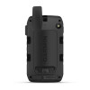
Garmin Montana 710i Handheld GPS
LOGIN IN TO SEE MEMBER PRICING IF AVAILABLE.
Use the "Request Quote" button below for quotes, bulk discounts, out-of-stock, regulated products, or tax-exempt sales.
- SKU:
- Garmin-010-02964-00
- UPC:
- 753759336882
- MPN:
- 010-02964-00
- Availability:
- Shipped from our or manufacturers warehouse, You will be notified of any delays. Your card will not be charged until product ships.
- Weight:
- 0.60 LBS




Related Products


Garmin Montana 710 Handheld GPS
Garmin


Garmin Montana® 760i Handheld GPS
Garmin


Garmin GPSMAP 67i Handheld GPS
Garmin


Garmin GPSMAP 86sci Marine Handheld GPS
Garmin
Description
Garmin Montana 710i Handheld GPS with inReach Satellite Communication
The Garmin Montana 710i is a rugged handheld GPS navigator built for hunters, hikers, overlanders, off-road travelers, outdoor professionals, and backcountry users who want large-screen mapping with integrated satellite communication. It combines a glove-friendly 5-inch touchscreen, preloaded topographic maps, inReach two-way satellite messaging, interactive SOS, location sharing, ABC navigation sensors, long battery life, and durable construction designed for demanding outdoor use.
The Montana 710i is especially well suited to users who travel beyond cellular coverage but do not need the built-in camera found on the Montana 760i. It delivers the same core navigation and inReach communication platform in a straightforward GPS-focused configuration.
Built-In inReach Satellite Communication
Integrated inReach technology allows the Montana 710i to communicate over the Iridium satellite network when cellular service is unavailable.
With an active satellite subscription and a clear view of the sky, users can send and receive two-way text messages, share location information, send check-in messages, and access supported satellite communication services from remote areas.
An active inReach satellite subscription is required for satellite messaging, tracking, supported weather services, and interactive SOS functionality.
Interactive SOS
The Montana 710i includes a dedicated SOS function for requesting assistance through Garmin Response when an active inReach subscription is enabled.
The system supports two-way communication, allowing users to provide additional information about an emergency while response coordination is underway.
Location Sharing and Tracking
With an active inReach subscription, the Montana 710i can transmit location information at configured intervals so family members, teammates, or other contacts can follow progress during remote travel.
This can be particularly useful during multi-day hunts, backcountry trips, overland travel, or professional field work where conventional cellular tracking may not be available.
Garmin Messenger Compatibility
The Montana 710i works with the compatible Garmin Messenger app for supported messaging and inReach account functions.
The Garmin ecosystem can use available cellular, Wi-Fi, or satellite connectivity depending on the environment, helping keep communication organized through a single compatible application.
Group Messaging
Compatible Garmin Messenger configurations support group messaging, giving users another way to communicate with multiple contacts during remote trips and outdoor activities.
Large 5-Inch Touchscreen
The Montana 710i features a large 5-inch color touchscreen with a 480 x 800-pixel resolution.
The large display provides significantly more map area than many traditional handheld GPS units, making topographic detail, routes, satellite imagery, waypoints, and navigation information easier to read at a glance.
Glove-Friendly Operation
The touchscreen is designed for glove-friendly use, making the Montana 710i practical in cold weather, while riding an ATV or motorcycle, or during outdoor work where bare-hand touchscreen operation may be inconvenient.
The display also supports both portrait and landscape orientation for handheld or compatible mounted use.
Preloaded TopoActive Maps
The Montana 710i includes preloaded TopoActive maps for detailed outdoor navigation.
Topographic mapping can display terrain contours, elevation information, coastlines, rivers, landmarks, trails, roads, and other geographic features directly on the handheld.
Multicontinent Topographic Mapping
The Montana 710i supports downloadable TopoActive maps from multiple regions around the world.
This makes the device useful for users who travel beyond a single country or region and want to maintain detailed mapping directly on the GPS.
High-Resolution Satellite Imagery
Users can download high-resolution satellite imagery directly to the Montana 710i over Wi-Fi.
Photorealistic overhead imagery provides additional context for terrain, roads, vegetation, clearings, water features, access routes, and other geographic details that may not be immediately apparent on a conventional topographic map.
Outdoor Maps+ Compatibility
The Montana 710i supports Outdoor Maps+ for users who want additional premium mapping layers and regularly updated map content.
Outdoor Maps+ requires a separate subscription where available.
32 GB Internal Memory
The Montana 710i includes 32 GB of internal memory for maps, satellite imagery, waypoints, routes, activities, and other supported data.
This provides substantial storage for users who maintain multiple regional maps or extensive navigation databases.
microSD Expansion
A built-in microSD card slot provides additional storage flexibility for compatible map and data files.
Multi-GNSS Navigation
The Montana 710i supports GPS and Galileo satellite positioning systems for dependable navigation across a wide range of outdoor environments.
Access to multiple satellite constellations can improve positioning availability in challenging terrain compared with relying on GPS alone.
ABC Navigation Sensors
Built-in altimeter, barometer, and compass sensors provide additional navigation and environmental information beyond satellite positioning.
- Barometric Altimeter: Tracks elevation, ascent, and descent.
- Barometer: Monitors changes in atmospheric pressure.
- 3-Axis Electronic Compass: Provides directional information even when the user is standing still.
Waypoint and Route Navigation
The Montana 710i supports extensive waypoint, route, track, and activity storage for users who regularly plan and record complex trips.
- Waypoints / Favorites / Locations: Up to 10,000
- Routes: Up to 200
- Track Log: Up to 20,000 points
- Saved GPX Tracks: Up to 250
- Saved FIT Activities: Up to 300
TracBack Navigation
TracBack can help guide users back along a previously traveled route, making it easier to return toward a trailhead, vehicle, camp, or starting point after navigating unfamiliar terrain.
Garmin Explore Compatibility
The Montana 710i works with the Garmin Explore app for planning and managing waypoints, courses, activities, and trip data.
Routes and locations can be prepared on a compatible mobile device and synchronized with the handheld, reducing the need to build every trip directly on the Montana touchscreen.
Active Weather
When paired with a compatible smartphone and supported Garmin services, the Montana 710i can access Active Weather information.
Optional inReach weather services may also be available through an active satellite subscription when cellular connectivity is unavailable.
Dog Tracking Compatibility
For hunters and dog handlers, the Montana 710i can pair with compatible Garmin Alpha and Astro series handhelds to display supported dog tracking information.
This allows the Montana to serve as part of a broader Garmin hunting and outdoor navigation ecosystem.
Built-In LED Beacon Flashlight
The Montana 710i includes a built-in LED beacon flashlight that can provide convenient illumination or signaling capability in the field.
It serves as a useful backup light for low-light navigation, campsite tasks, or emergency situations.
MIL-STD-810 Rugged Construction
The Montana 710i is tested to MIL-STD-810 standards for thermal, shock, water, and vibration performance.
This makes it well suited to hiking, hunting, boating, off-road travel, motorcycles, ATVs, professional field work, and other applications where electronics may be exposed to impacts, vibration, temperature changes, and harsh weather.
IPX7 Water Rating
The Montana 710i carries an IPX7 water rating, providing protection against incidental immersion in water up to 1 meter deep for up to 30 minutes under specified test conditions.
Designed for Handheld and Vehicle Use
The Montana platform is compatible with a wide range of optional mounting solutions for ATVs, motorcycles, boats, cars, RVs, bicycles, and other vehicles.
This allows the same GPS used on foot to transition into a mounted navigation system for vehicle-based exploration.
Compatible mounts and powered cradles are sold separately.
High-Capacity 4350mAh Battery
The Montana 710i uses an included 4350mAh rechargeable lithium-ion battery pack.
The higher-capacity battery helps provide substantially longer runtime than earlier Montana 700-series configurations while retaining the removable battery design.
Extended Battery Life
- GPS Mode with Message or Location Sent Every 10 Minutes: Up to 24 hours
- Expedition Mode: Up to 432 hours
- Expedition Mode with Message or Location Sent Every 30 Minutes: Up to 384 hours
- Powered Off: Up to 1 year
Battery estimates assume a full view of the sky. Heavy tree cover, terrain, display use, satellite messaging, wireless connectivity, temperature, and other conditions can significantly affect actual runtime.
USB-C Charging and Data
The Montana 710i uses a modern USB-C interface for charging and data transfer.
This is an important upgrade over the micro-USB connection used on earlier Montana 700-series models.
No Built-In Camera
The Montana 710i does not include a built-in camera. Users who want the same generation of Montana navigation and inReach functionality with an integrated 8-megapixel geotagging camera should consider the Montana 760i.
Key Features
- Rugged handheld GPS navigator with inReach technology
- Two-way satellite messaging with active subscription
- Interactive SOS with active subscription
- Satellite location sharing and tracking
- Check-in messaging
- Garmin Messenger compatibility
- Group messaging support
- Optional inReach weather services
- 5-inch color touchscreen
- Glove-friendly operation
- Portrait and landscape display orientation
- 480 x 800-pixel display resolution
- Preloaded TopoActive maps
- Multicontinent TopoActive map support
- High-resolution satellite imagery
- Outdoor Maps+ compatibility
- GPS satellite support
- Galileo satellite support
- Barometric altimeter
- Barometer
- 3-axis electronic compass
- Waypoint, route, and track navigation
- TracBack navigation
- Up to 10,000 waypoints
- Up to 200 routes
- Up to 20,000 track points
- Garmin Explore compatibility
- Active Weather support
- Compatible Alpha and Astro dog tracking integration
- Built-in LED beacon flashlight
- 32 GB internal memory
- microSD card support
- Wi-Fi connectivity
- Bluetooth connectivity
- ANT+ connectivity
- USB-C interface
- MIL-STD-810 tested for thermal, shock, water, and vibration
- IPX7 water rating
- 4350mAh rechargeable lithium-ion battery
- Up to 24 hours in GPS mode with 10-minute messaging/location intervals
- Up to 432 hours in Expedition Mode
- Compatible with multiple optional vehicle mounts
Specifications
- Manufacturer: Garmin
- Model: Montana 710i
- Manufacturer Part Number: 010-02964-00
- UPC: 753759336882
- Product Type: Handheld GPS / Satellite Communicator
- Physical Dimensions: 3.6" x 7.2" x 1.3" (9.19 x 18.30 x 3.27 cm)
- Weight: 14.5 oz (410 g) with Included Lithium-Ion Battery Pack
- Display Size: 2.55" W x 4.25" H; 5" Diagonal
- Display Resolution: 480 x 800 Pixels
- Touchscreen: Yes
- Display Orientation: Portrait and Landscape
- inReach Satellite Communication: Yes
- Built-In Camera: No
- Preloaded Maps: TopoActive
- Satellite Imagery: Direct-to-Device Download over Wi-Fi
- Outdoor Maps+ Compatibility: Yes
- Internal Memory: 32 GB
- External Memory: microSD Card Support
- Waypoints / Favorites / Locations: Up to 10,000
- Routes: Up to 200
- Track Log: Up to 20,000 Points
- Saved GPX Tracks: Up to 250
- Saved FIT Activities: Up to 300
- Satellite Systems: GPS and Galileo
- Compass: 3-Axis Electronic Compass
- Altimeter: Barometric
- Built-In LED Beacon Flashlight: Yes
- Wireless Connectivity: Wi-Fi, Bluetooth, ANT+
- Interface: USB-C
- Water Rating: IPX7
- Environmental Testing: MIL-STD-810 for Thermal, Shock, Water, and Vibration
- Battery Type: Rechargeable Lithium-Ion Battery Pack
- Battery Capacity: 4350mAh
- GPS Battery Life: Up to 24 Hours with Message or Location Sent Every 10 Minutes
- Expedition Battery Life: Up to 432 Hours
- Operating Temperature: -4°F to 140°F (-20°C to 60°C)
Important Model Difference
The Garmin Montana 710i 010-02964-00 includes integrated inReach satellite communication but does not include an 8-megapixel camera. The Montana 760i adds the built-in geotagging camera while retaining the core navigation and inReach functionality of this generation.
Important inReach Information
The Montana 710i can perform standard GPS navigation and use downloaded maps without an active inReach subscription. However, satellite messaging, satellite tracking and location sharing, interactive SOS, and supported inReach weather services require an active satellite subscription.
Some jurisdictions regulate or prohibit satellite communication devices. Users are responsible for understanding and following applicable laws in every location where the Montana 710i will be used.
WARNING This product may contain chemicals known to the State of California to cause cancer and birth defects or other reproductive harm. For more information, visit www.P65Warnings.ca.gov. You must be 18 or older to shop or purchase on our website, and 21 or older to purchase ammunition or firearms. Check local laws before ordering. By ordering, you certify that you meet all federal, state, and local legal requirements. There are no returns or exchanges on armor, firearms, ammunition, or PPE. Ammunition ships UPS Ground to the lower 48 states.
We reserve the right to correct critical errors.